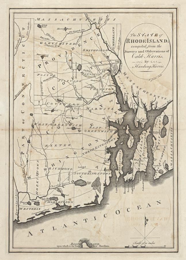
ARTIST: Harding Harris
PUBLISHER: Published by Mathew Carey, Philadelphia.
MEDIUM: Copper plate engraving,
DATE: c.1795.
EDITION SIZE: Image size 13 3/8 x 9 3/8" (342 x 238 mm).
DESCRIPTION: A detailed map of the Ocean State. Depicted are roads, bridges, ferries, villages and cities as well as a small portion of Block Island. Mathew Carey of Philadelphia was the first major American publisher of maps and atlases. In 1795 he published "Carey's American Atlas," which was the first atlas drawn, engraved and published in America. This atlas contained 21 maps, primarily of American interest. Later in 1795 Carey produced "The General Atlas for Carey's Edition of Guthrie's Geography Improved" which contained the 21 American maps issued in the American Atlas as well as maps of the rest of the world. In 1796, Carey reissued "The General Atlas," dropping any mention of Guthrie and adding a large map of the U.S. by Samuel Lewis. This map appeared in the 1796 issue. Any of these maps are considered to be scarce in today's market. Engraved by J. Smither.
ADDITIONAL INFO: First state. 1795.
CONDITION: Good condition save for some faint offset. Black and white.
REFERENCE: Wheat & Brun #250, state 1.


 Login / Register
 Basket