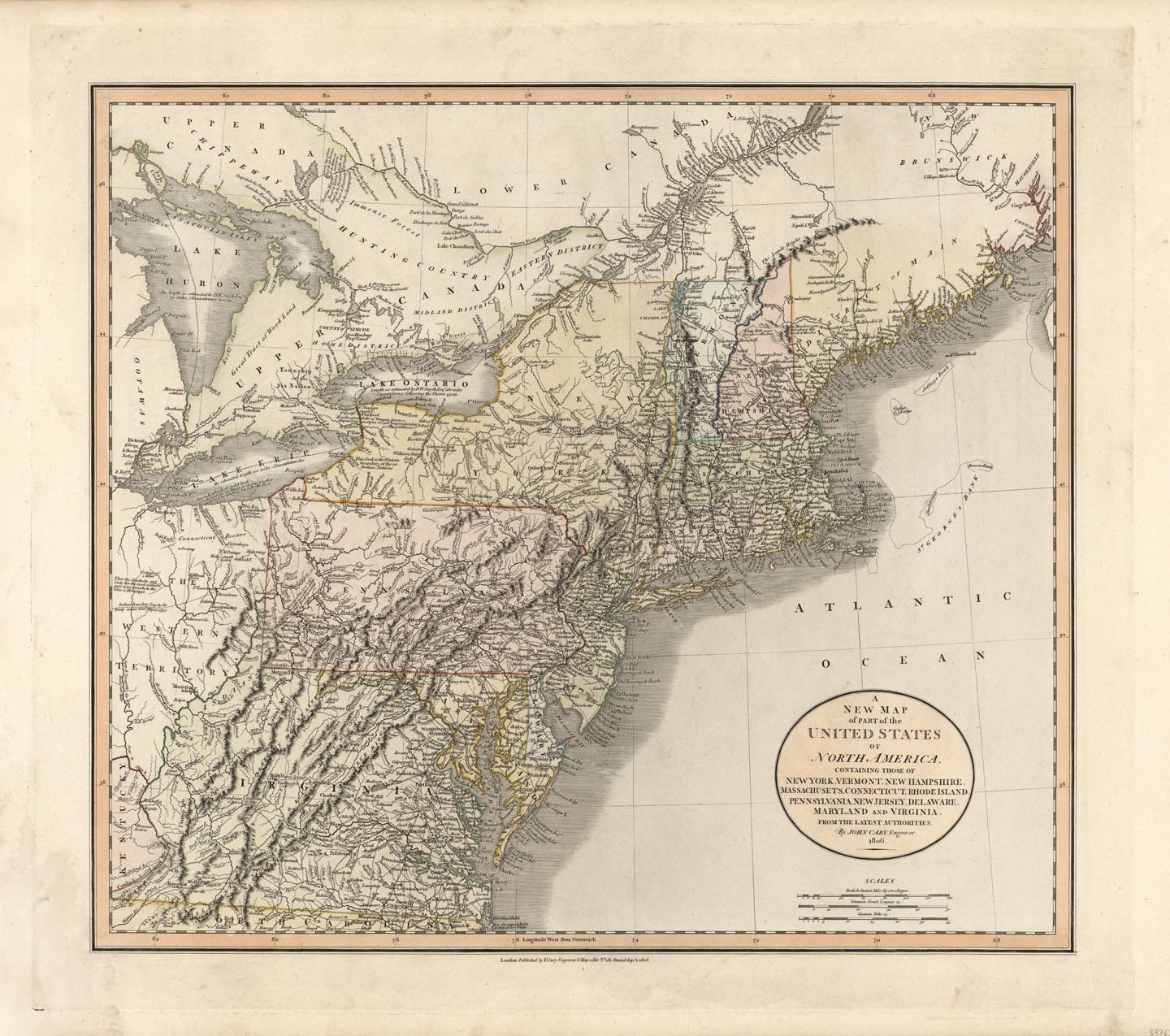
ARTIST: John Cary
PUBLISHER: Published by J. Cary, London.
MEDIUM: Copper plate engraving.
DATE: 1806.
EDITION SIZE: Image size 18 1/16 x 20 1/2" (458 x 523 mm) plus margins.
DESCRIPTION: This map depicts the growing northern half of the young United States. Shown is a portion of the Western Territory which on this map is today's Ohio and a portion of Indiana. North eastern Ohio is noted as the "Connecticut Reserve". All the states and territories shown have been colored individually. An attractive map.
ADDITIONAL INFO:
CONDITION: Good condition. Original coloring
REFERENCE:


 Login / Register
 Basket