ARTIST: Ormando Gray
PUBLISHER: Published by E.D. & H.C. Marsh, Philadelphia.
MEDIUM: Stone engraving,
DATE: 1875
EDITION SIZE: 16 1/4 x 25" (412 x 638 mm) plus margins.
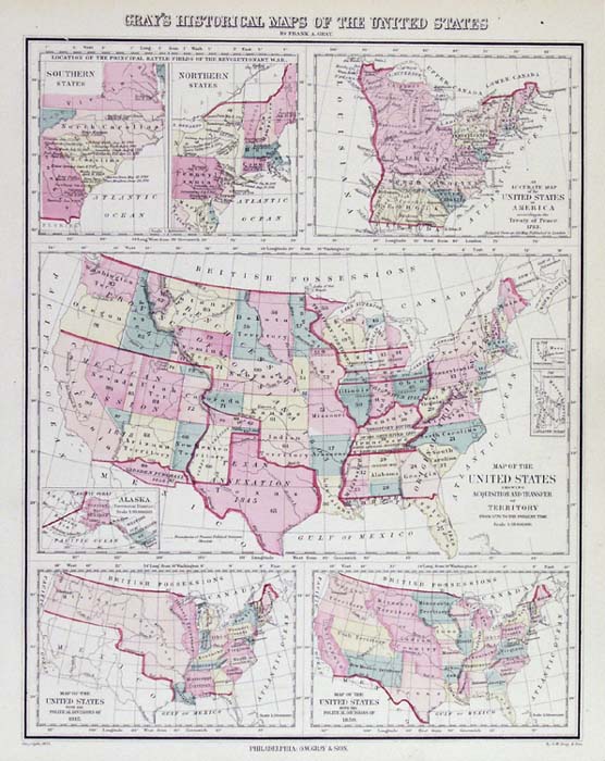
DESCRIPTION: A decorative and well engraved map from "Gray's Atlas of the United States." This map shows six historical maps, two give the locations of the principal battle fields of the Revolution. One gives the outline of the U.S. according to the treaty of peace of 1783. The main map shows the "acquisition and transfer of territory" from 1776 to 1875. And the two lower maps depict the political divisions in 1815 and 1850. An interesting map.
ADDITIONAL INFO:
CONDITION: Good condition and color.
REFERENCE:


 Login / Register
 Basket