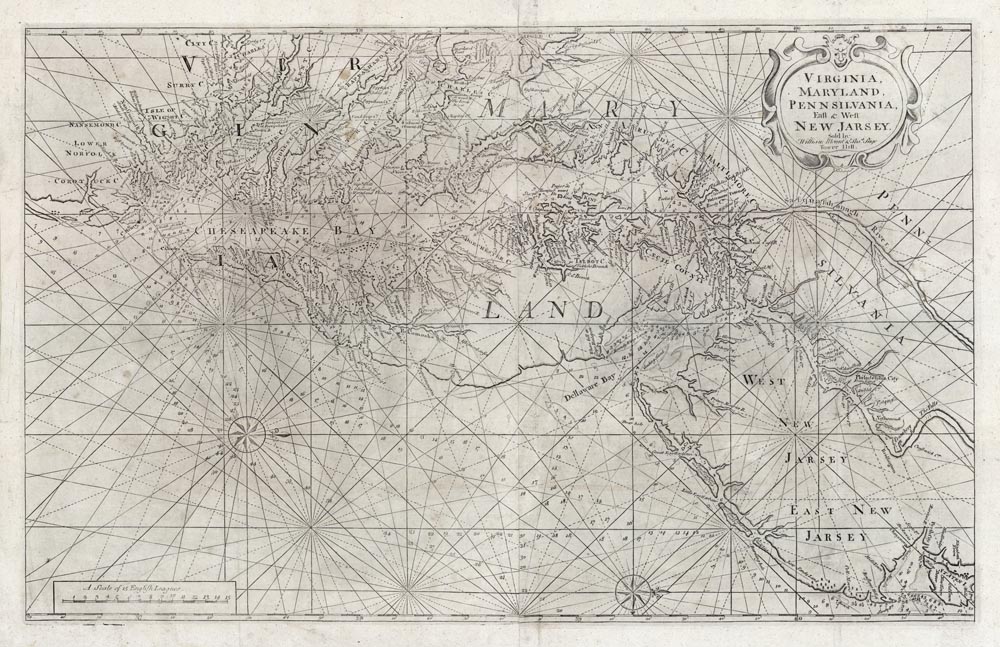
ARTIST: John Thornton
PUBLISHER: Published by William Mount & Thomas Page, London.
MEDIUM: Copper plate engraving,
DATE: 1689 - c.1750.
EDITION SIZE: Two sheet map, joined. Image size 20 x 31 3/8 (506 x 796 mm) plus margins.
DESCRIPTION: A classic map of the Chesapeake and Delaware bays that is based on the extremely rare and important Augustine Herrman four-sheet map of 1673. John Seller, who published the Hermann map, also produced a reduced version for inclusion his “Atlas Maritimus” in 1675. William Fisher and John Thornton who worked with and then took over from Seller, produced another variant, this version, for inclusion in “The English Pilot – The Forth Book” It first appeared in 1689 and appeared in this work with slight variations or states for over the next hundred years 100 years. Cartographically it shows an area from Staten Island, westward into Pennsylvania and southward to Currituck County in northern North Carolina. Includes river and coastal soundings, hundreds of place names, shoals, rhumb lines and two compass roses.
ADDITIONAL INFO: A very nice tall paper example.
CONDITION: Good condition. Black & white.
REFERENCE: Papenfuse & Coale "Historical Map of Maryland" pp. 32-40.


 Login / Register
 Basket