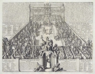
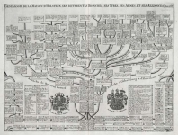
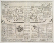
ARTIST: Henri Chatelain
PUBLISHER: Published in Amsterdam by L’Honore & Chatelain.
MEDIUM: Copper plate engraving printed on fine laid paper,
DATE: 1720
EDITION SIZE: 18 7/8 x 24 3/4" (480 x 629 mm) plus margins.
DESCRIPTION: This impressive engraving is a wonderful example of Chatelain’s elegant plates. Included in the 1720 edition of Atlas Historique, published by Chatelain in Amsterdam, this large chart is the third map in volume three. This impressive map covers the whole of England and Wales and includes the Isle of Man. There is small inset map of Northumberland in the upper right corner of the sheet as well as numerous key tables listing the principal cities and counties. Highly detailed, this meticulous map is one of the finest charts in the atlas, and a wonderful example from the golden age of French cartography.
ADDITIONAL INFO:
CONDITION: Good condition. Black and white.
REFERENCE: Phillips, A List of Geographical Atlases in the Library of Congress, 305, 548, & 579; Moreland & Bannister, Antique Maps; Koeman, Atlantes Neerlandici, vol. II. p. 33-38.


 Login / Register
 Basket