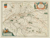
ARTIST: Joan Blaeu
PUBLISHER: Published by Guiljelmum Blaeu, Amsterdam.
MEDIUM: Copper plate engraving,
DATE: c.1650.
EDITION SIZE: 16 1/8 x 19 3/4" (41 x 50.1 cm) plus margins.
DESCRIPTION: This map covers an area from India to Japan and includes all of the East Indies. It was the first popular map to depict the west coast of Australia. Blaeu’s map is especially accurate and up to date because he was then the official cartographer to the Dutch East India Company, whose trading empire covered the entire area. Nicely embellished with two cartouches, sailing ships, and aquatic putti.
ADDITIONAL INFO:
CONDITION: Good condition save for some splitting in lower centerfold. Some damp staining in lower margins. Original hand coloring.
REFERENCE: #223 in "The Mapping of Australia" by R. V. Tooley; #40 in "Australia Unveiled" by Gunter Schilder.


 Login / Register
 Basket