ARTIST: John Seller
PUBLISHER: Printed for William Fisher at the Postern on Tower Hill, and John Thornton at the Plat in the Minories. London.
MEDIUM: Copper plate engraving,
DATE: 1689-1698.
EDITION SIZE: Image size 16 x 9 1/2" (40.8 x 24.1 cm).
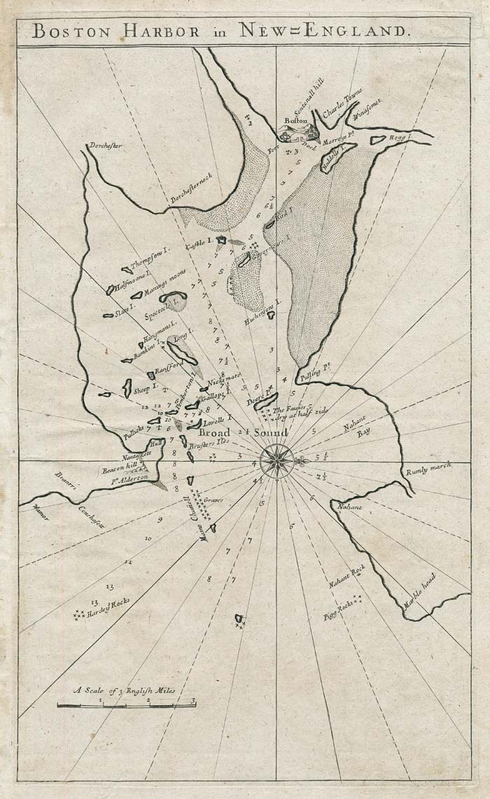
DESCRIPTION: The first printed chart of Boston. This chart only appeared in the first two printed editions of "The English Pilot, The Fourth Book." This work, the first English produced sea-atlas of American waters, was first issued in 1689, by William Fisher and John Thornton, and again in 1698 by John Thornton and Richard Mount. The chart was replaced with another in the next printed edition. Very few examples are known to exist, fewer than ten in the world. The idea for English Pilot series (six parts in all) started with John Seller. Throughout the 17th century the Dutch controlled the chart publishing business. The growth of the American Colonies and the Navigation acts of the 1650's ensured that only English flagged ships could trade with them. English shipping flourished, doubling in tonnage size between 1600 and 1700 with the bulk of this growth happening in the last half of the century. English chart makers had great incentive to supply the market. John Seller (c1630-1697) of London was a mapseller, instrument maker and writer on navigation. In 1669 he issued his first work on the subject, "Practical Navigation." In 1671, he issued the first of what would become the English Pilot series. Financial difficulties later required him to involve others in the project, thus the names John Thornton, William Fisher and Richard Mount appear. The last known copy of this chart was sold to Norman Leventhal in 1991.
ADDITIONAL INFO:
CONDITION: Very good condition, save for a small area of paper loss in the upper right corner, not affecting the printed image. Black & white.
REFERENCE: "Mapping Boston" by Krieger and Cobb. p. 94.


 Login / Register
 Basket