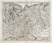
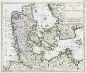
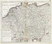
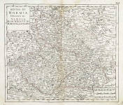
ARTIST: Giovanni Albrizzi
PUBLISHER: Published by Giovanni Albrizzi, Venice.
MEDIUM: Copper plate engraving.
DATE: 1740
EDITION SIZE: Image size 12 3/4 x 14" (324 x 362 mm).
DESCRIPTION: A fine map from "Atlante Novissimo Che Contiene Tutte Le Parti Del Mondo...." This atlas was published in Venice and was based on the work of Isaak Tirion, which in turn was based largely on the work of Guillaume De L’Isle.
ADDITIONAL INFO:
CONDITION: Good condition save for some rippling in the paper. Original outline hand coloring.
REFERENCE:


 Login / Register
 Basket