PUBLISHER: Published by Johnson & Browning, New York.
MEDIUM: Engraving handcolored,
DATE: c.1860.
EDITION SIZE: Image size 13 x 15 7/8" (33 x 40.3 cm).
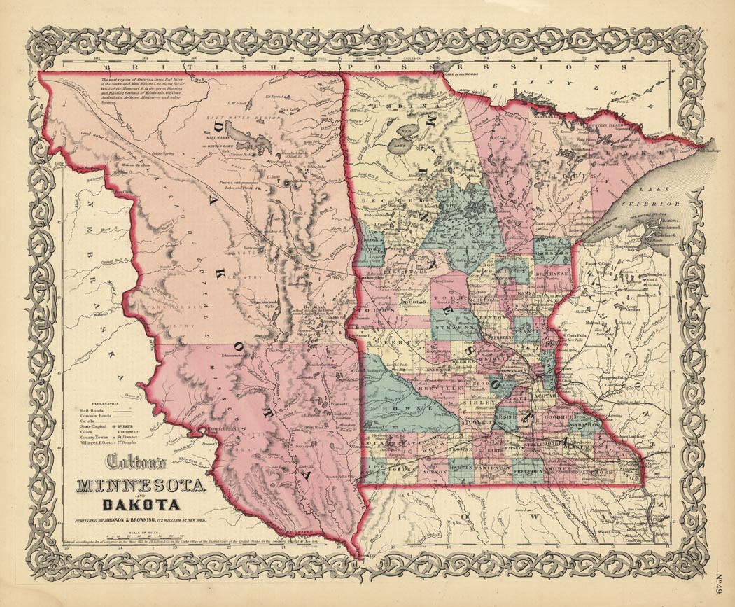
DESCRIPTION: A pleasant and decorative map from "Colton's Atlas of America…". On this map Minnesota has been divided into counties and townships. Dakota extends to the Missouri River. "The newly formed Dakota Territory is a huge unorganized area with its western boundary along the Missouri River. A notation in the northwestern portion of Dakota atates the region “is the great Hunting and Fighting Ground of Dakotah, Odjebwe, Assiniboin, Arikara, Minitarree and other Nations."
ADDITIONAL INFO:
CONDITION: Good condition and color.
REFERENCE:


 Login / Register
 Basket