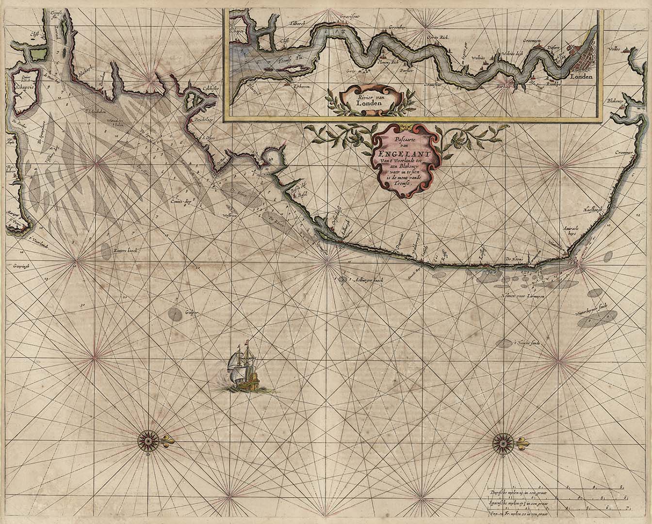
ARTIST: Pieter Goos
MEDIUM: Copper plate engraving,
DATE: c.1676.
EDITION SIZE: 17 x 21 3/8" (429 x 541 mm) plus margins.
DESCRIPTION: A fine early Dutch sea chart of the Thames River and surrounding English coastline. This chart is riented with north to the right. In the upper right is a large inset of the Thames includes a plan of London. This chart appeared in Goos “De Zee-Atlas, Ofte Water-Weereld….” Embellished with two compass roses and a galleon under sail.
ADDITIONAL INFO:
CONDITION: Good condition. Original hand coloring.
REFERENCE:


 Login / Register
 Basket