ARTIST: George Eldridge
PUBLISHER: Published by Kelvin & Wilfrid O. White Co. New York, Boston and Montreal. Nautical Instruments. "The Best of Everything in Navigational Equiptment."
MEDIUM: Lithograph,
DATE: c1905.
EDITION SIZE: 19 x 14" (482 x 355) plus margins.
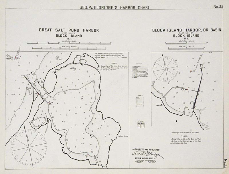
DESCRIPTION: Two detailed charts on one sheet. Great Salt Pond (New Harbor) is shown on the left, Old harbor on the right. Noted are soundings, channel markers, (colored in red), hazards and anchorages, towns and a compass rose. This chart appeared in George W. Eldridge’s “Harbor Chart-Book.”
ADDITIONAL INFO:
CONDITION: Good condition save for some minor damp staining in the lower right corner.
REFERENCE:


 Login / Register
 Basket