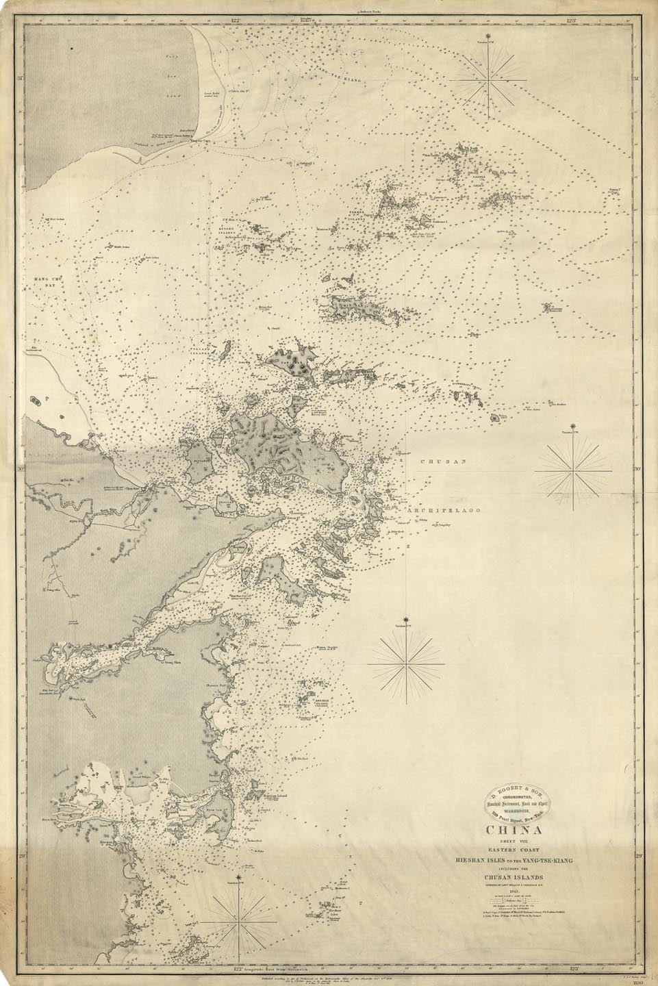
ARTIST: J. Walker
PUBLISHER: Published at the Hydrographic Office of the Admiralty, August 15th 1849, London.
MEDIUM: Engraving
DATE: 1843
EDITION SIZE: Image size 24 5/8 x 37 1/2 " (947 x 625 mm) plus margins
DESCRIPTION: A fine, large scale chart. This chart depicts a stretch of the Eastern Coast of China, complete with depth soundings and notes on the topography and tides, with emphasis on the Chusan archipelago.
ADDITIONAL INFO:
CONDITION: Good condition save for a slight discoloration of about 5" high across the entire bottom margin. Uncolored.
REFERENCE:


 Login / Register
 Basket