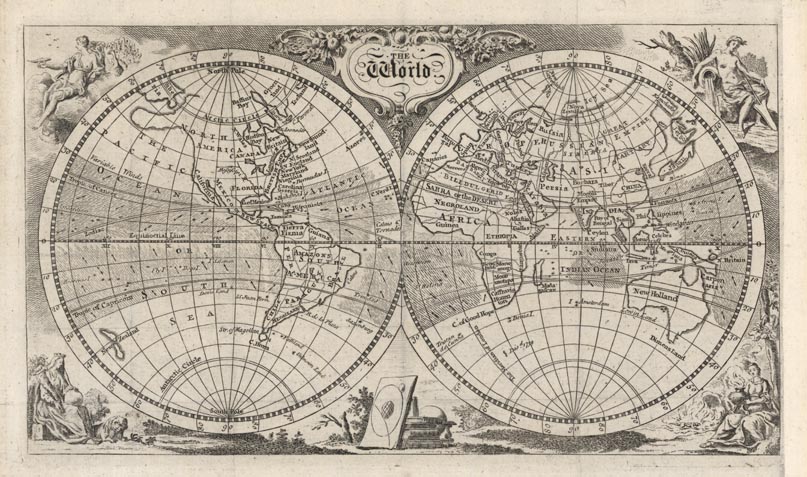
ARTIST: Thomas Jefferys
MEDIUM: Copper engraving,
DATE: c. 1757.
EDITION SIZE: Image size 5 15/16 x 10 7/16" (151 x 265 mm).
DESCRIPTION: Double-hemispheric world map with a shaded area between the tropics illustrating the prevailing winds. In North America the entire seaboard is labeled “British Emp,” with Georgia, Carolina, Virginia, Maryland, New York and New England all named. The Great Lakes appear, as does the Mississippi River. In the eastern hemisphere, New Holland (Australia) is mapped in full. But except for a tiny landfall discovered in 1739, the Antarctic continent does not appear at all. In the corners are decorative figures representing the elements – fire, water, earth and air.
ADDITIONAL INFO:
CONDITION: Good condition with extended margin on right. Black and white.
REFERENCE:


 Login / Register
 Basket