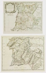
ARTIST: Nicolas Sanson
PUBLISHER: Published by Pierre Mortier, Amsterdam.
MEDIUM: Copper engraving, hand colored,
DATE: 1705.
EDITION SIZE: . Image size 14 1/4 x 19 3/16" (363 x 487 cm).
DESCRIPTION: From "Atlas Antiquus" by Jean Le Clerc. Map of ancient Africa north of the Atlas Mountains, in particular the Barbary Coast from modern-day Morocco through the Tripoli region of Libya. A large title cartouche covers the lower third of the map. The region north of the mountains is depicted in detail with towns and ports, islands, regional divisions, and smaller mountain ranges.<br><br>Sanson was a royal geographer and councilor of state of France, and his work is considered highly influential within the French cartographical tradition. Sanson created maps of Europe, as well as regions throughout the world during an age of European exploration in different continents.
ADDITIONAL INFO:
CONDITION: Good condition with original wash color.
REFERENCE: Le gear 5628. Koeman Mor 4.


 Login / Register
 Basket