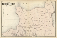
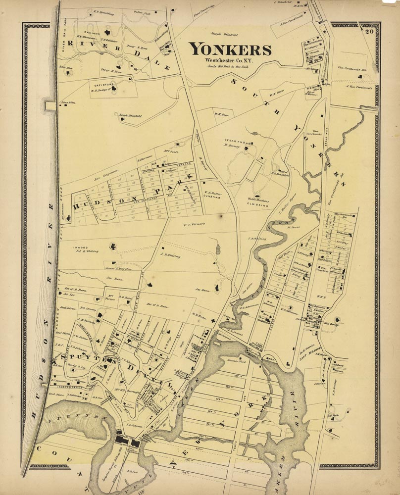
ARTIST: F. W. Beers
PUBLISHER: Published by Beers, Ellis and Soule. NY.
MEDIUM: Handcolored stone engraving,
DATE: 1867
EDITION SIZE: Image size 17 5/8 x 12 1/2" (450 x 320 mm) plus margins.
DESCRIPTION: A handsome map of this area. This map is from "Atlas of New York and Vicinity" by F. W. Beers. Homes, businesses and owners names are shown. Can be paired with plate 21 with same title.
ADDITIONAL INFO:
CONDITION: Good condition with original color. Some paper toning and possible tears along paper edge.
REFERENCE:


 Login / Register
 Basket
![Adams. [and] Hancock. [Towns of].](https://oldprintshop.com/uploads/jpg/24298_productthumb.jpg)