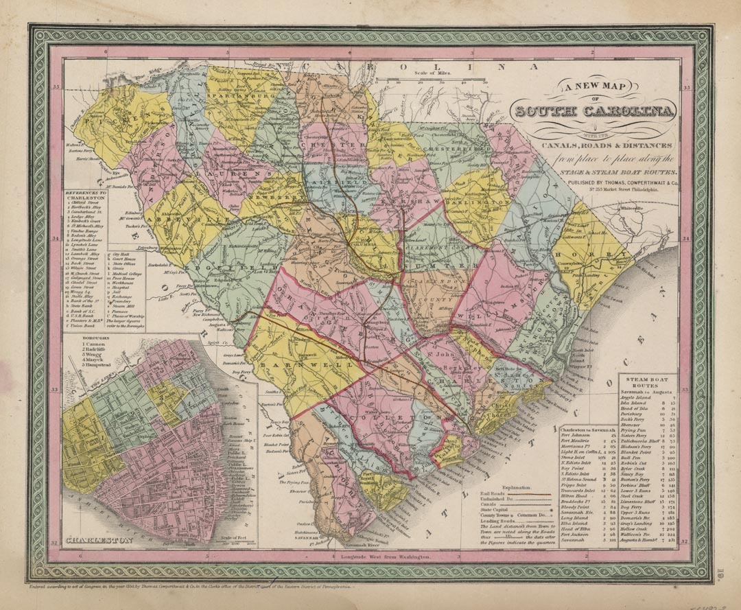
ARTIST: Thomas, Cowperthwait & Co.
PUBLISHER: Published by Thomas, Cowperthwait & Co., Philadelphia.
MEDIUM: Engraving, hand colored,
DATE: 1850.
EDITION SIZE: Image size 11 3/8 x 14 1/8" (29 x 35.9 cm).
DESCRIPTION: This map appeared inthe Cowperthwait edition of Mitchell’s "A New Universal Atlas containing maps of the various Empires, Kingdoms, States and Republics of the World." Itr shows counties, towns, railroads and topographical features. At lower left is a keyed inset plan of Charleston. The railroad line between Charleston and Hamburg (Augusta, Ga.) was completed in 1833, and was at that time the longest in the world. The map also has a table of steamboat route distances.
ADDITIONAL INFO:
CONDITION: Good condition save for some slight staining in the margins.
REFERENCE:


 Login / Register
 Basket