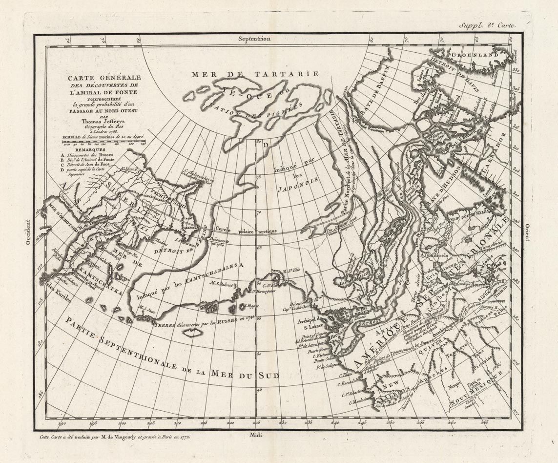
ARTIST: Didier Robert de Vaugondy
PUBLISHER: Published in Paris.
MEDIUM: Copper engraving,
DATE: 1772.
EDITION SIZE: Image size 11 1/4 x 13 15/16" (286 x 355 mm).
DESCRIPTION: Map no. 8 from the supplement to the Diderot and d'Alembert Encyclopaedie, 1770-1779. This map of arctic America and the Bering Strait concentrates on illustrating Admiral de Fonte's claim to the existence of a Northwest Passage, here leading to Baffin Bay and Davis Strait. Alaska is shown as a peninsula rather than the group of islands so often mapped. Other geographic information is adapted from maps of the Russian discoveries in 1741 and an earlier Japanese map.
ADDITIONAL INFO:
CONDITION: Good condition.
REFERENCE:


 Login / Register
 Basket