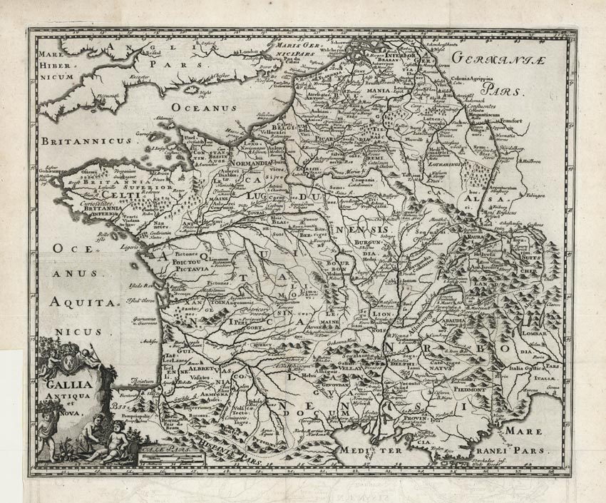
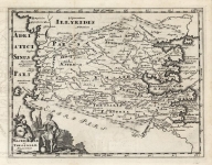
ARTIST: Philip Cluver
PUBLISHER: Published by Johann Pauli, Amsterdam
MEDIUM: Copper plate engraving,
DATE: 1729
EDITION SIZE: 10 5/8 x 12 3/4" (270 x 325 mm) plus margins.
DESCRIPTION: This historical map of France and Belgium shows 'modern' topography with ancient place names. It is simply adorned with a strapwork title cartouche. Appeared in "Introductionis in Universam Geographiam...".
ADDITIONAL INFO:
CONDITION: Good condition. Trimmed tight to lower left corner as issued.
REFERENCE:


 Login / Register
 Basket