Price: $135.00
SKU: 81171
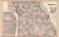
ARTIST: Ormando Gray
PUBLISHER: Published by Philadelphia: O.W. Gray & Son.
MEDIUM: Stone engraving,
DATE: 1876
EDITION SIZE: Image size 15 x 12" (385 x 305 mm) plus margins.
DESCRIPTION: A fine of the Dakota Territory shown in its 1868-89. configuration. Notes railroad lines, Indian agencies, town and villages in the territory. In 1889 the Dakota Territory was divided into two separate states and admitted to the union. This map appeared in Grays "National Atlas."
ADDITIONAL INFO: From an 1883 edition of the atlas.
CONDITION: Good condition and original hand coloring.
REFERENCE:


 Login / Register
 Basket