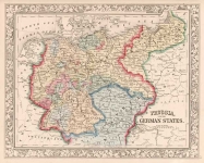
ARTIST: Samuel Augustus Mitchell
PUBLISHER: Published by Thomas, Cowperthwait & Co., Philadelphia.
MEDIUM: Handcolored engraving,
DATE: 1850-55.
EDITION SIZE: Image size 14 x 11 3/8" (35.4 x 28.8 cm).
DESCRIPTION: A fine map from Cowperthwait edition of Mitchell's "A New Universal Atlas containing maps of the various Empires, Kingdoms, States and Republics of the World." Mitchell is one of the first truly successful commercial cartographers in the U.S. Shown is a table of distances for steamboat routes and a profile of the Wabash and Erie Canal.
ADDITIONAL INFO:
CONDITION: Good condition and color.
REFERENCE:


 Login / Register
 Basket