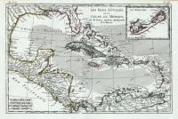
ARTIST: Rigobert Bonne
MEDIUM: Copper plate engraving,
DATE: 1787.
EDITION SIZE: Image size for each, 13 5/8 x 9 1/4" (34.8 x 23.5 cm) plus margins.
DESCRIPTION: Pair of maps covering the territory of the new United States. Partie Orientale covers the eastern seaboard, Partie Occidentale covers the Appalachian Mountains to the Mississippi River and northern plains. Virginia, North & South Carolina, and Georgia are shown with their western boundaries extending to the Mississippi River. Delineates many towns, villages, settlements, frontier forts, missions, mines, and Indian villages. These two maps appeared in Bonne's "Atlas Encyclopedique." Engraved by Andre. A very attractive example.
ADDITIONAL INFO:
CONDITION: Good condition and color.
REFERENCE: Sellers & Van Ee "Maps and Charts of North America and the West Indies" #794


 Login / Register
 Basket