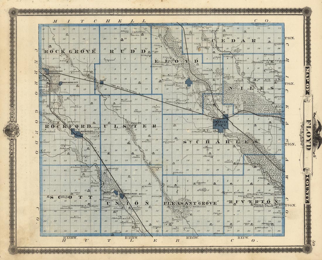
ARTIST: A. Andreas
PUBLISHER: Published by the Andreas Atlas Co., Chicago.
MEDIUM: Two-color stone engraving,
DATE: 1875.
EDITION SIZE: Image size 13 1/4 x 17" (33.5 x 43 cm) plus margins.
DESCRIPTION: A detailed map from "A. T. Andreas' Historical Atlas of the State of Iowa." Shows the towns of Rockford, Charles City, Floyd and Marble Rock. Gives many homeowners names. The map is surrounded by a nice decorative border.
ADDITIONAL INFO:
CONDITION: Good condition save for some soiling in the lower left corner.
REFERENCE:


 Login / Register
 Basket