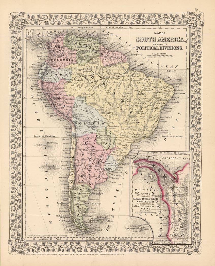
ARTIST: Samuel Augustus Mitchell
PUBLISHER: Published by S. A. Mitchell, Philadelphia.
MEDIUM: Handcolored engraving,
DATE: 1866.
EDITION SIZE: 13 3/8 x 10 1/2" (338 x 268 mm) plus margins.
DESCRIPTION: From "Mitchell's New General Atlas,…". Nicely embellished with a Grape vine border. The inset in the lower right shows the proposed Panama Canal or "Atrato-Inter-Oceanic Canal Routes".
ADDITIONAL INFO:
CONDITION: Good condition. Original hand coloring.
REFERENCE:


 Login / Register
 Basket