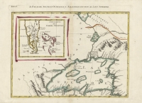
ARTIST: Antonio Zatta
PUBLISHER: Published by Antonio Zatta, Venice.
MEDIUM: Engraving with original outline color,
DATE: 1778
EDITION SIZE: 12 3/8 x 16 9/16" (31.4 x 42. cm) plus margins.
DESCRIPTION: Plate 7 from "Le Colonie unite dell' America settentrle" - a twelve sheet atlas based on John Mitchell's "Map of the British and French Dominions in North America". This map is centered on the junction of the Mississippi and Ohio Rivers and includes parts of Missouri (including the St. Louis area), Illinois, Indiana, Kentucky and a portion of north western Tennessee.
ADDITIONAL INFO:
CONDITION: Good condition save for some damp staining along right edge. Original outline color.
REFERENCE:


 Login / Register
 Basket