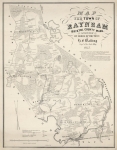
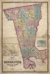
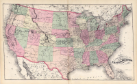
ARTIST: Henry Walling
PUBLISHER: Published by H. F. Walling & O. H. Gray. Boston
MEDIUM: Stone engraving
DATE: 1871
EDITION SIZE: Image 15 x 23 7/8" (38 x 60.7)
DESCRIPTION: A handsome map of the growing U.S. The Dakotas remain undivided and Oklahoma is still called Indian Territory. Major railroad lines are named and their tracks or projected routs across the country are delineated.
ADDITIONAL INFO:
CONDITION: Good condition and color.
REFERENCE:


 Login / Register
 Basket