ARTIST: Alexander Bache
PUBLISHER: Published by the United States Coast and Geodetic Survey.
MEDIUM: Engraving,
DATE: 1851.
EDITION SIZE: Image size 14 5/8 x 16 3/4" (37 x 42.7 cm)
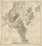
DESCRIPTION: A fine sea chart of Key West and environs. In the upper right are sailing directions.
ADDITIONAL INFO:
CONDITION: Good condition save for some slight browning along fold lines.
REFERENCE:


 Login / Register
 Basket