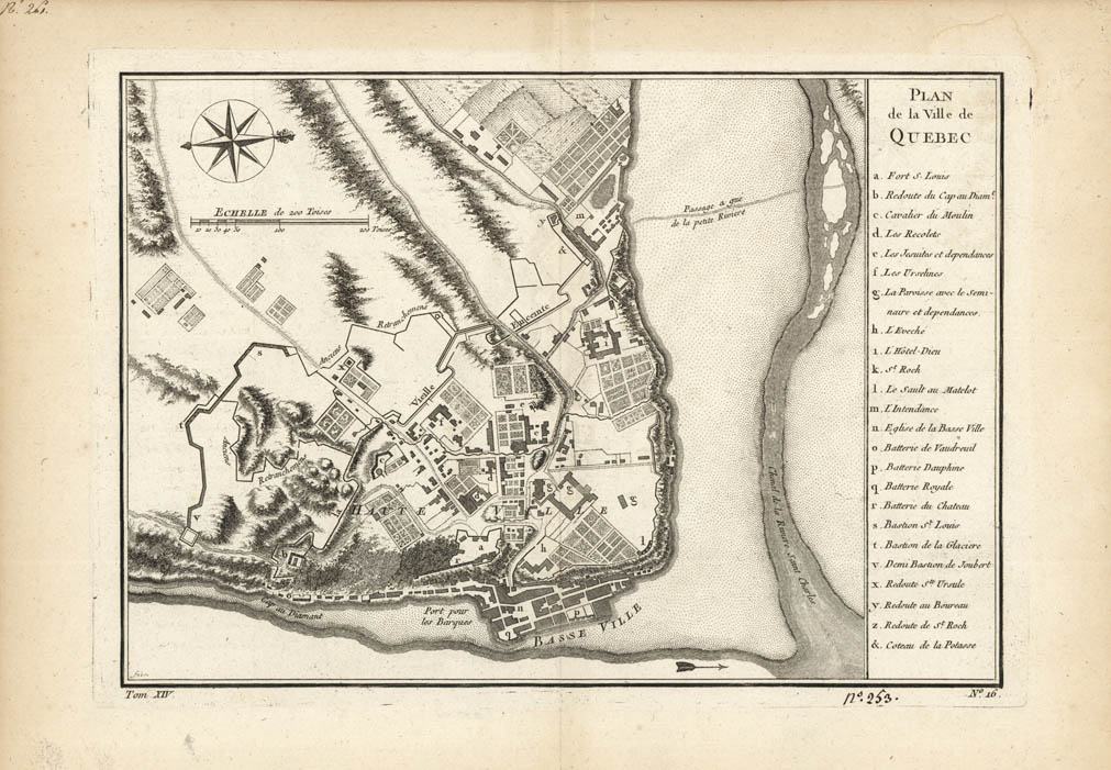
ARTIST: Jacques Bellin
PUBLISHER: Published by Jean Francois de La Harpe, Paris.
MEDIUM: Copper plate engraving,
DATE: c. 1757.
EDITION SIZE: Image 7 3/4 x 11 1/8" (19.6 x 28.3 cm).
DESCRIPTION: A fine early map of the city of Quebec showing the city's fortifications with a key at right identifying the major buildings. This map appeared in Prevost's "L'Histoire Generale des Voyages".<br><br> The cartographer Jacques Nicolas Bellin (1703-1772) was one of the most important and proficient French cartographers of the eighteenth century. He was appointed the first Ingenieur Hydrographe de la Marine, and also the Official Hydrographer to the French King. <br><br>
ADDITIONAL INFO:
CONDITION: Good condition. B/W
REFERENCE:


 Login / Register
 Basket