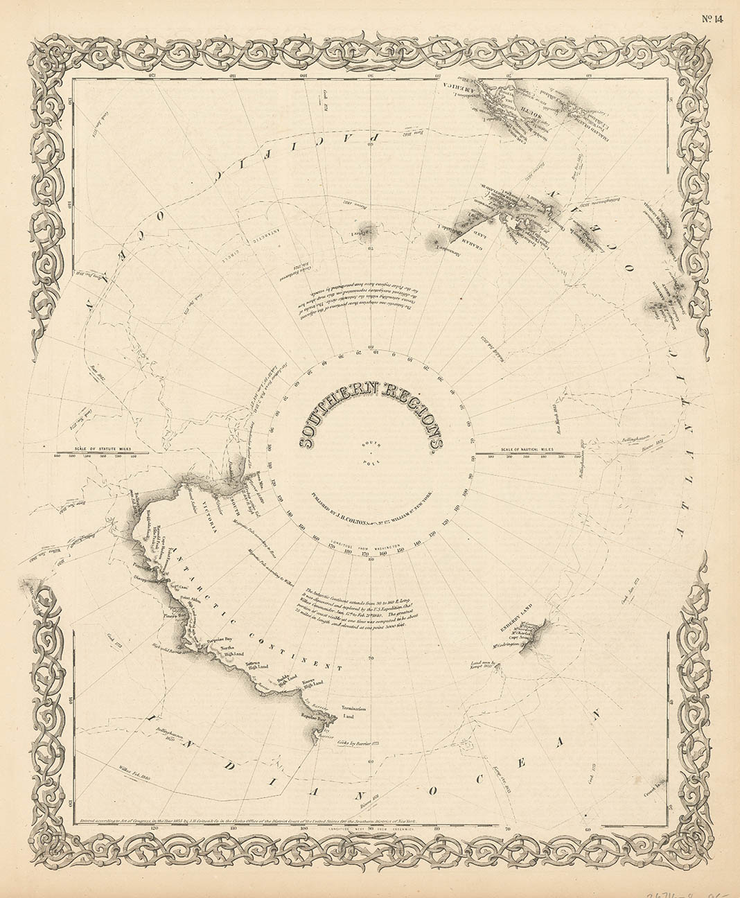
ARTIST: J. H. Colton
PUBLISHER: Published by J. H. Colton and Company, New York.
MEDIUM: Engraving handcolored,
DATE: 1855-56.
EDITION SIZE: Image size 12 3/4 x 15 1/2" (32.6 x 39.6 cm).
DESCRIPTION: A decorative and well engraved map from "Colton's Atlas of the World." This map gives the known coast line of the Antarctic continent. Noted are the tracts of Cook, WilkesRoss, Bellinghausen, Weddel and Biscoe. The tip of South America and the Fakland islands can be seen in the upper right.
ADDITIONAL INFO:
CONDITION: Good condition. B/W
REFERENCE:


 Login / Register
 Basket