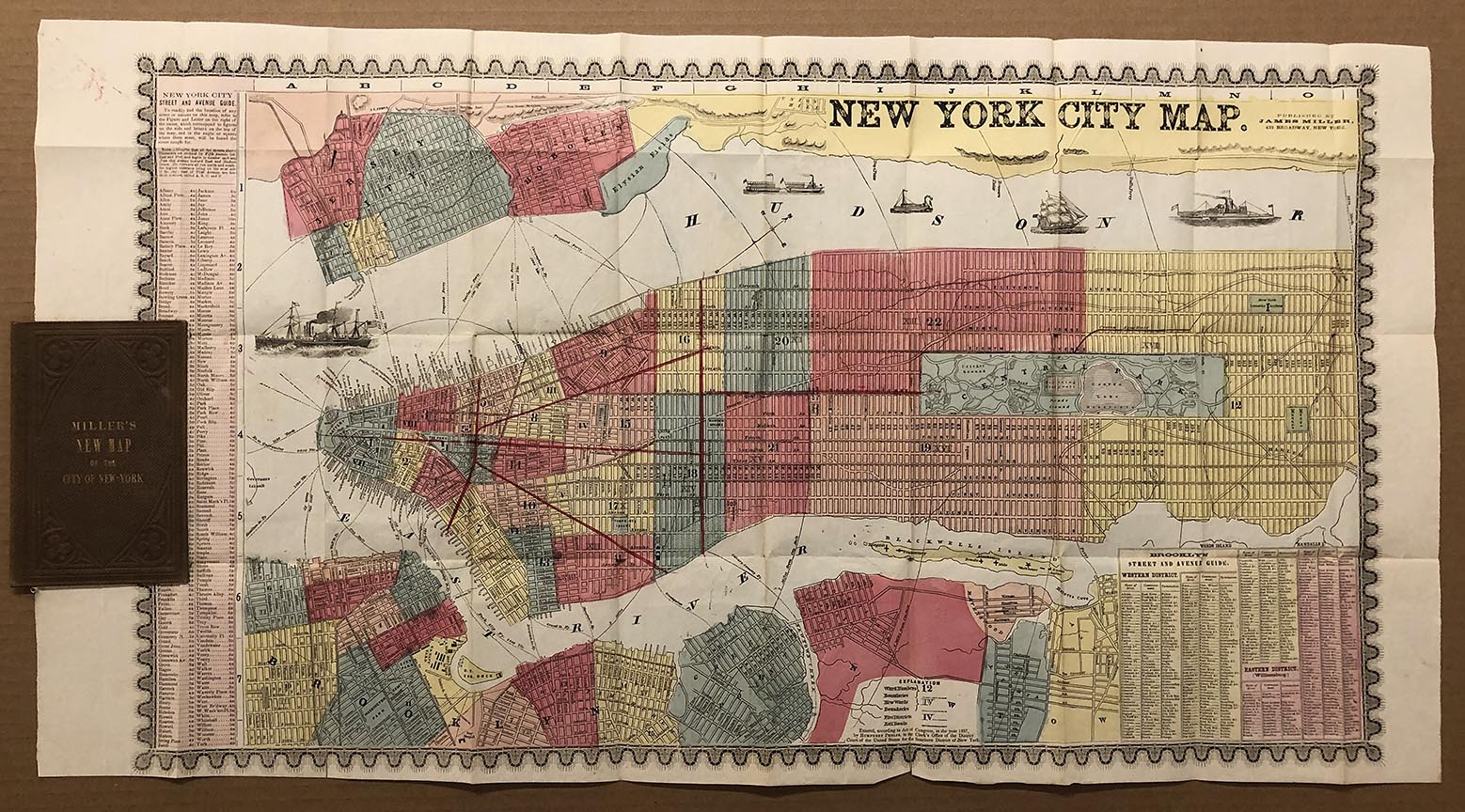
ARTIST: Humphrey Phelps
PUBLISHER: Published by James Miller, 413 Broadway, New York.
MEDIUM: Engraving,
DATE: 1857-c.1860.
EDITION SIZE: 16 1/2 x 29 1/4" (42 x 74.3 cm) including decorative borders.
DESCRIPTION: An attractive early guide map of the city. The map is hand colored by ward and somewhat detained. Keys identify streets, wards, fire districts and railroads. Surrounding Manhattan is Jersey City, Hoboken and Elysian Fields, just outside of Hoboken, which is believed to be the site of the first organized baseball game. On the lower edge is Brooklyn Heights, Dumbo, Vinegar Hill, Williamsburgh, Greenpoint, Long Island City and a small portion of Astoria. Also shows early ferry routes between Manhattan, Long Island and New Jersey.
ADDITIONAL INFO: Still bound into original hard brown cloth covers.
CONDITION: Good condition save for some minor splits along fold lines.
REFERENCE:


 Login / Register
 Basket