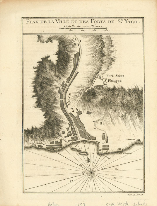
ARTIST: Jacques Bellin
MEDIUM: Copper plate engraving,
DATE: 1764.
EDITION SIZE: Image size 8 3/8 x 5 3/4" (21.1 x 14.7 cm) plus margins.
DESCRIPTION: Plan of the Forts and Town of St. Yago in the Cap Verde Islands. This map was produced by Bellin for Prevost d'Exiles' influential travel book, ‘L'Histoire Generale des Voyages’. Fort Saint Philippe is shown on the high ground.
ADDITIONAL INFO:
CONDITION: Good condition. B/W
REFERENCE:


 Login / Register
 Basket