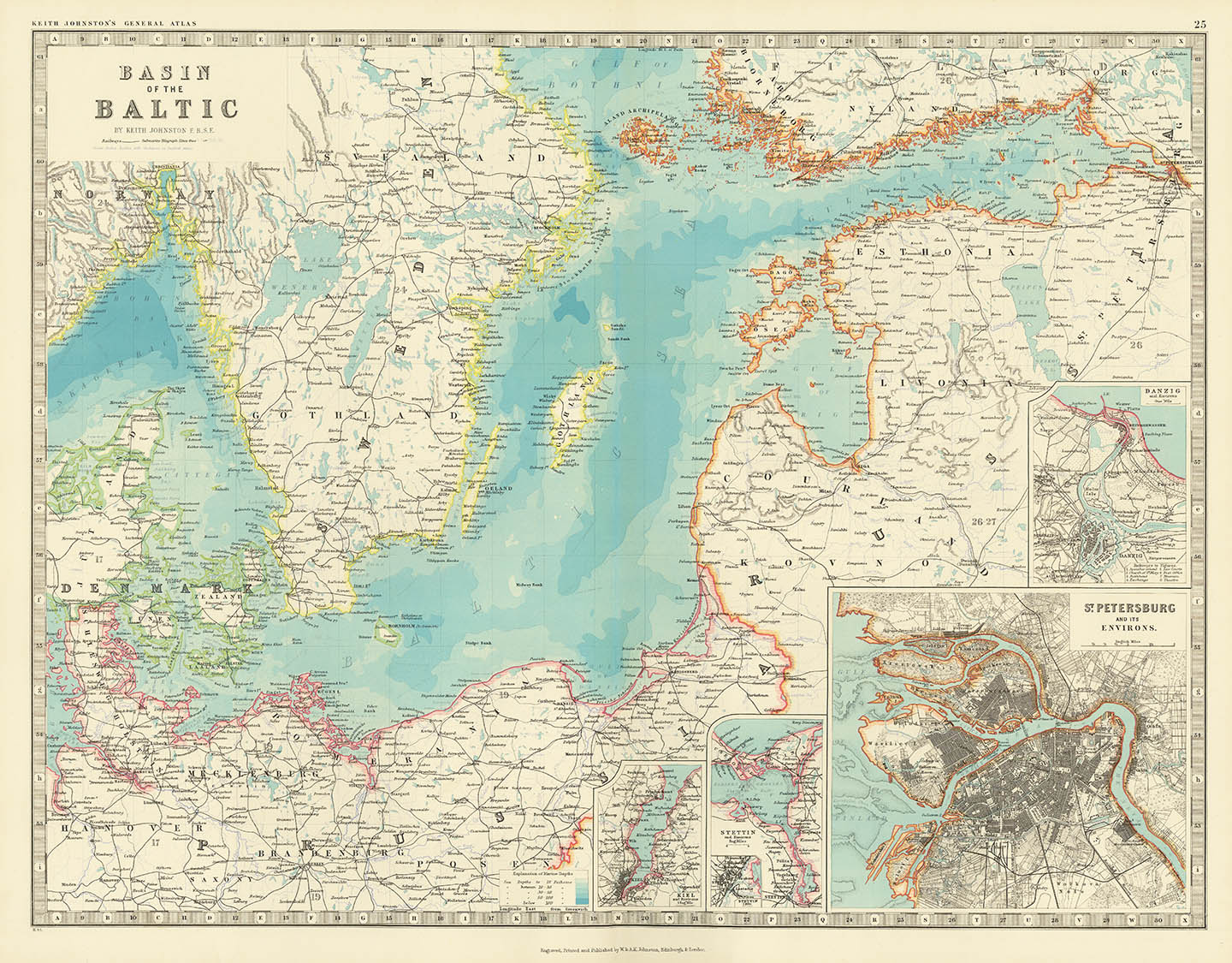
ARTIST: Keith Johnston
PUBLISHER: Published by W. & A. K. Johnston, Edinburgh & London.
MEDIUM: Multi-stone lithograph
DATE: 1897.
EDITION SIZE: Image size 17 1/2 x 22 1/2" (44.5 x 57.3 cm).
DESCRIPTION: A detailed map of the Baltic that appeared in Johnston's "The Royal Atlas of Modern Geography." Retains two index sheets of names and locations. Includes a keyed index sheet. Shows Estonia, Livonia, Courland and Kovno. Inset maps inclue St. Petersburg, Danzig, Kiel and Stettin.
ADDITIONAL INFO:
CONDITION: Good condition and color.
REFERENCE:


 Login / Register
 Basket