ARTIST: J. H. Colton
PUBLISHER: Published by J. H. Colton & Co., New York.
MEDIUM: Handcolored engraving,
DATE: 1855.
EDITION SIZE: Image size, 12 1/2 x 16" (32 x 40.5 cm) plus margins.
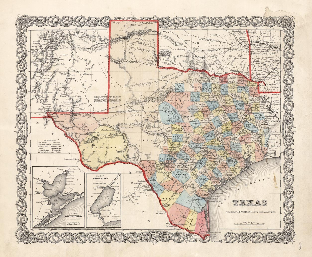
DESCRIPTION: In 1855, much of Texas was undeveloped. This map shows the Panhandle as being occupied by the Kiowa (Northern Comanches) and the west inhabited by Lepans and Southern Comanches. The Pacific Railroad link, between Fort Belknap and El Paso, is only a proposed route here. The insets show the "Plan of Galveston Bay and the "Plan of Sabine Lake". Many other interesting details. Plate 35 from Colton's "Atlas of the World".
ADDITIONAL INFO:
CONDITION: Good condition save for some minor stains in the margins. Original color.
REFERENCE:


 Login / Register
 Basket