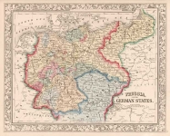
ARTIST: Samuel Augustus Mitchell
PUBLISHER: Published by S. A. Mitchell, Philadelphia.
MEDIUM: Handcolored engraving,
DATE: 1870
EDITION SIZE: 10 3/4 x 13 1/4" (273 x 338 mm) plus margins.
DESCRIPTION: From "Mitchell's New General Atlas,…". Nicely embellished with a Grape vine border.
ADDITIONAL INFO:
CONDITION: Good condition and color.
REFERENCE:


 Login / Register
 Basket