The Old Print Shop

  • Home
  • Shop
  • Maps
  • Correct draught of the North Pole and of all the countries hitherto discovered, intercepted between the pole and the parallel of 50 degrees. Exhibiting the most remarkable tracts of our English navigators &c in their several attempts to find out the North East and North West Passages.

Correct draught of the North Pole and of all the countries hitherto discovered, intercepted between the pole and the parallel of 50 degrees. Exhibiting the most remarkable tracts of our English navigators &c in their several attempts to find out the North East and North West Passages.

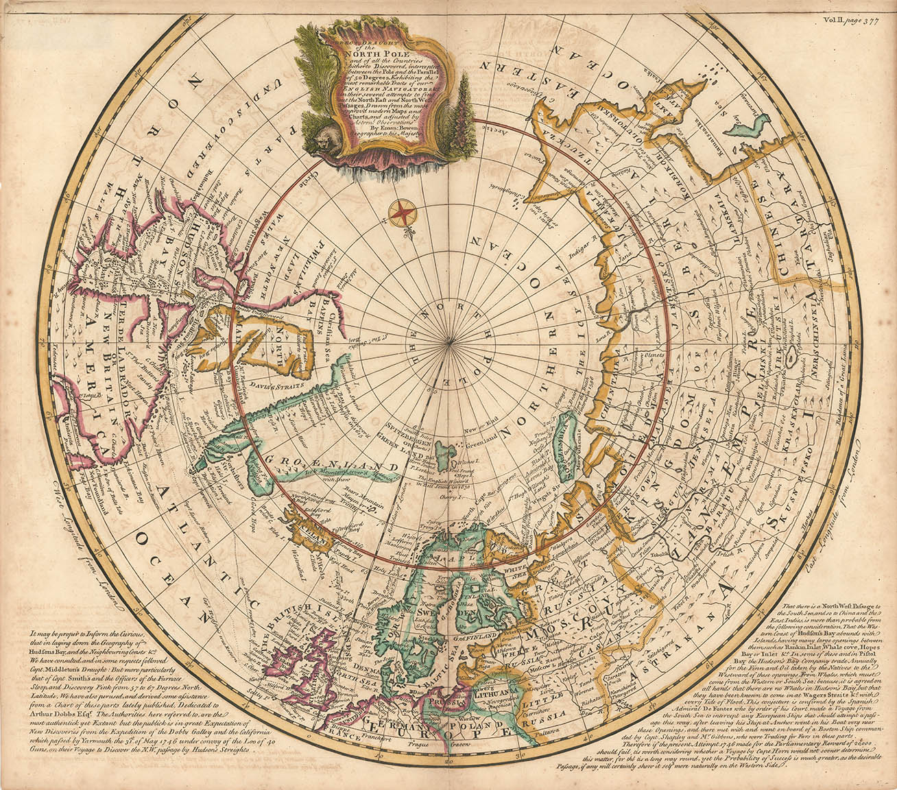
  • ARTIST: Emanuel Bowen

  • MEDIUM: Copper plate engraving

    DATE: c.1745

  • EDITION SIZE: Image size 15 1/4 x 16 3/4" (38.8 x 42.4 cm)

  • DESCRIPTION: This map is centered on the North Pole and highlights the attempts to discover the Northwest Passage. This is the second edition to which has been added the tracks of a number of early explorers, including Hudson, James, Jurd, Willoughby, Barentsz, and Wardhus.

  • ADDITIONAL INFO:

  • CONDITION: Good condition. Beautifully hand colored.

  • REFERENCE:

  • CATEGORIES: Maps