PUBLISHER: Published by the American Geographical Society.
MEDIUM: Stone engraving,
DATE: 1931
EDITION SIZE: Image size 19 3/4 x 28 3/8" (50 x 72 cm)
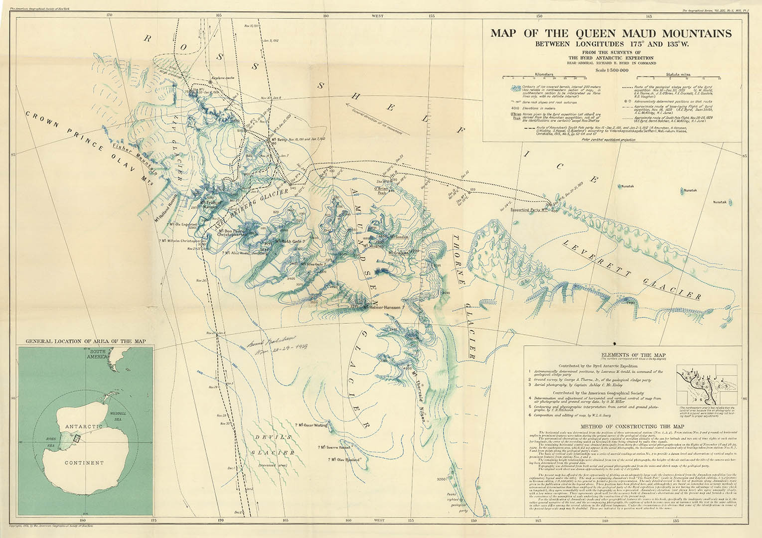
DESCRIPTION: The Queen Maud Mountains lie between the Beardmore and Reedy Glaciers and including the area from the head of the Ross Ice Shelf to the Antarctic Plateau in Antarctica. The map shows the route taken by Captain Roald Amundsen and party as they ascended Axel Heiberg Glacier in November 1911. Elevations bordering the Beardmore Glacier, at the western extremity of these mountains, were observed by the British expeditions led by Ernest Shackleton (1907–09) and Robert Falcon Scott (1910-13), but the mountains as a whole were mapped by several American expeditions led by Richard Evelyn Byrd (1930s and 1940s), and United States Antarctic Program (USARP) and New Zealand Antarctic Research Program (NZARP) expeditions from the 1950s through the 1970s. The map identifies a number of Mountains and Glaciers across the Maud Mountain Range. The map has an elaborate inset table identifying "Elements of the Map", showing the details contributed by Admiral Byrd's Antarctic Expedition and details contributed by the American Geographical Society. Below that is additional information titled "Method of Constructing The Map."
ADDITIONAL INFO:
CONDITION: Good condition save for occasional minor split along fold intersections.
REFERENCE:


 Login / Register
 Basket