Price: $500.00
SKU: 100678
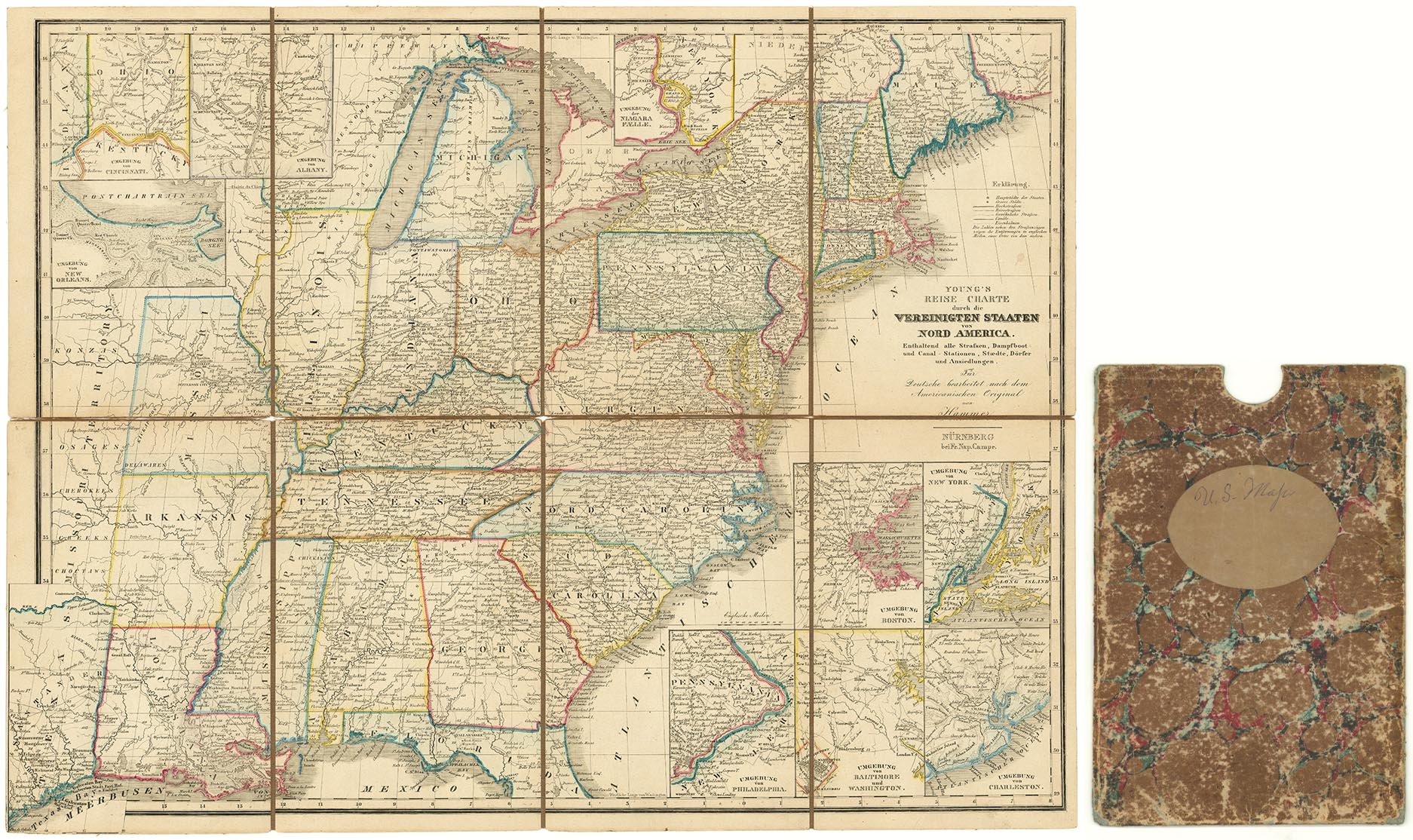
ARTIST: J. Young
PUBLISHER: Published by Thomas, Cowperthwait & Co. Philadelphia.
MEDIUM: Handcolored engraving,
DATE: 1855
EDITION SIZE: Image size 15 7/8 x 26 1/8" 40.2 x 66.4 cm) plus margins.
DESCRIPTION: This map is from "A New Universal Atlas containing maps of the various Empires, Kingdoms, States and Republics of the World". It is one of the most interesting maps of the United States to appear in a Commercial Atlas, and one of the earliest to extend from Coast to Coast. This edition includes a large inset of the Gold Region of California. Washington and Oregon extend to the Rocky Mountains. Massive Utah and New Mexico Territories extend from California to the Rockies and beyond. Nebraska Territory includes all of current day Montana and part of what would become Idaho. Minnesota Territory includes all of Dakota.<br><br> This edition of the map is one of the most interesting editions. During this extraordinary period of geo-political change in the west. Many early roads and explorer's routes are shown, along with Indian Tribes, forts and other details. Exceptional detail in Texas and east of the Sierra Nevada Mountains. Shows Fremont's route, Kearny's Route, the Oregon Trail, Santa Fe Trail, General Arbuckle's route and many others. Other interesting notes on Gold, Silver and Copper mines, Salt Ponds and many other early details.
ADDITIONAL INFO: This piece is in a 17.75 x 28 inch archival mylar for handling.
CONDITION: Good condition save for a faint vertical line along the centerfold. Some offset and minor spots. Original hand coloring.
REFERENCE:


 Login / Register
 Basket