ARTIST: A. Andreas
PUBLISHER: Published by Andreas Atlas Co., Chicago.
MEDIUM: Two-stone lithograph,
DATE: 1874..
EDITION SIZE: Image size 14 3/16 x 12 9/16" (36.1 x 32 cm) plus margins.
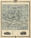
DESCRIPTION: A fine map from "An Illustrated Historical Atlas of the State of Minnesota." Printed by Chas. Shober & Co. Chicago. Printed on the back is a map of Rice County.
ADDITIONAL INFO:
CONDITION: Good condition and color save for stitch tears in right margin.
REFERENCE:


 Login / Register
 Basket