PUBLISHER: Published by Rand McNally & Co.
MEDIUM: Multi-color wax engraving.
DATE: 1893
EDITION SIZE: 9 1/8 x 12 1/2" (233 x 317 mm) plus margins.
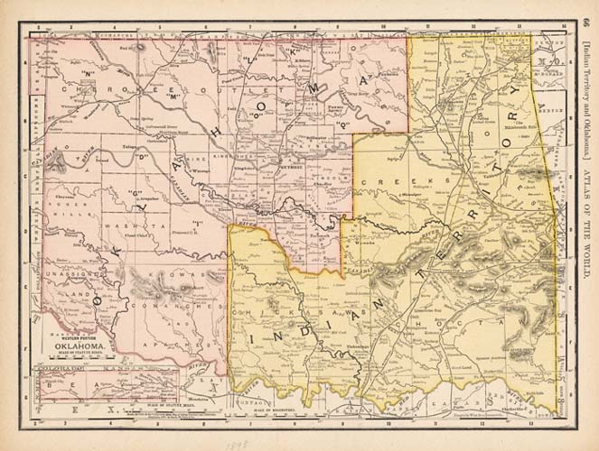
DESCRIPTION: This map appeared in Rand McNally's "Universal Atlas." This map depicts the early configuration of present day Oklahoma. The western portion of Oklahoma became the Oklahoma Territory in 1890. The name came from a Choctaw term which means "red people." The eastern portion of the state remained the Indian Territory. Originally, both areas petitioned to become separate states, but they were refused. Then they combined forces and united. Oklahoma became the 46th state in 1907.
ADDITIONAL INFO:
CONDITION: Good condition and color.
REFERENCE:


 Login / Register
 Basket