Price: $95.00
SKU: 34375
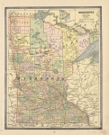
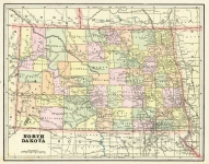
ARTIST: George Cram
MEDIUM: Multi-color roto-lithograph,
DATE: 1887.
EDITION SIZE: Image size 16 1/4 x 22 1/4" (410 x 593 mm) plus margins.
DESCRIPTION: A very detailed map from "Cram's Standard American Railway Atlas. Covers what is now North and South Dakota. Depicted are counties, railroads, railway stations, township surveys, post offices, mountains, rivers, lakes, and other details. Mail routes are noted in red. A decorative title enhances this map as well.
ADDITIONAL INFO:
CONDITION: Good condition and color. On reverse: index of railroads, counties, and towns.
REFERENCE:


 Login / Register
 Basket