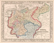
ARTIST: Samuel Augustus Mitchell
PUBLISHER: Published by Thomas, Cowperthwait & Co. Philadelphia.
MEDIUM: Engraving handcolored,
DATE: 1850
EDITION SIZE: Image size 11 3/8 x 14 1/2" (29.1 x 36.8 cm).
DESCRIPTION: This map is from "A New Universal Atlas containing maps of the various Empires, Kingdoms, States and Republics of the World." The inset gives the census information for Maryland by county, including slaves.
ADDITIONAL INFO: From an 1853 edition of the atlas.
CONDITION: Good condition and color.
REFERENCE:


 Login / Register
 Basket