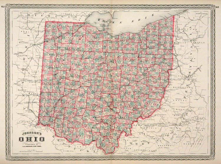
ARTIST: A. Johnson
PUBLISHER: Published by A. J. Johnson, New York.
MEDIUM: Engraving handcolored,
DATE: 1865 (1883)
EDITION SIZE: Image size 16 3/4 x 22 1/2" (427 x 572 mm).
DESCRIPTION: This map was published in "Johnsons New Illustrated Family Atlas of the World." This detailed map notes railroad lines, lakes, rivers, counties, towns and cities. A nice bright and well colored impression of this map. A finely engraved calligraphic border surrounds the map.
ADDITIONAL INFO:
CONDITION: Very good condition and color.
REFERENCE:


 Login / Register
 Basket