ARTIST: Fielding Lucas, Jr.
PUBLISHER: Published by Carey & Lea, Philadelphia.
MEDIUM: Handcolored copper plate engraving,
DATE: c.1822.
EDITION SIZE: 16 1/2 x 20 1/2" (420 x 518 mm) including text, plus margins.
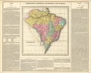
DESCRIPTION: A fine map from Carey and Lea's "A Complete Historical, Chronological, and Geographical American Atlas." Published in Philadelphia. Shown are the islands of Martinique, St. Lucia, St. Vincent, Barbadoes, Grenada, Tobago, and Trinidad. The text gives a "historical sketch" of each island, as well as a general description of each. Drawn by F. Lucas Jr.
ADDITIONAL INFO:
CONDITION: Good condition, save for some occasional minor stains.
REFERENCE:


 Login / Register
 Basket


![Geographical, Statistical, and Historical Map of the United Provinces of South America. [Argentina]](https://oldprintshop.com/uploads/jpg/23531_productthumb.jpg)