PUBLISHER: Published by the St. Paul Litho, Eng. and Publishing Co.
MEDIUM: Lithograph handcolored with colored text,
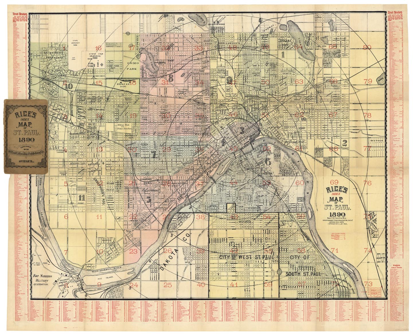
DATE: 1890
EDITION SIZE: Image size 23 1/4 x 28 1/2" (591 x 724 mm).
DESCRIPTION: A great pocket map of the city. The key identifies the locations of the streets and public parks. In the lower left corner is Fort Snelling Military Reservation and in the lower right corner St. Paul Union Stock Yards. Scale 2 3/4" to the mile. Copyright by G. Jay Rice.
ADDITIONAL INFO:
CONDITION: Good condition and color, save for minor splitting at the fold intersections with the original covers.
REFERENCE:


 Login / Register
 Basket