Price: $145.00
SKU: 47774
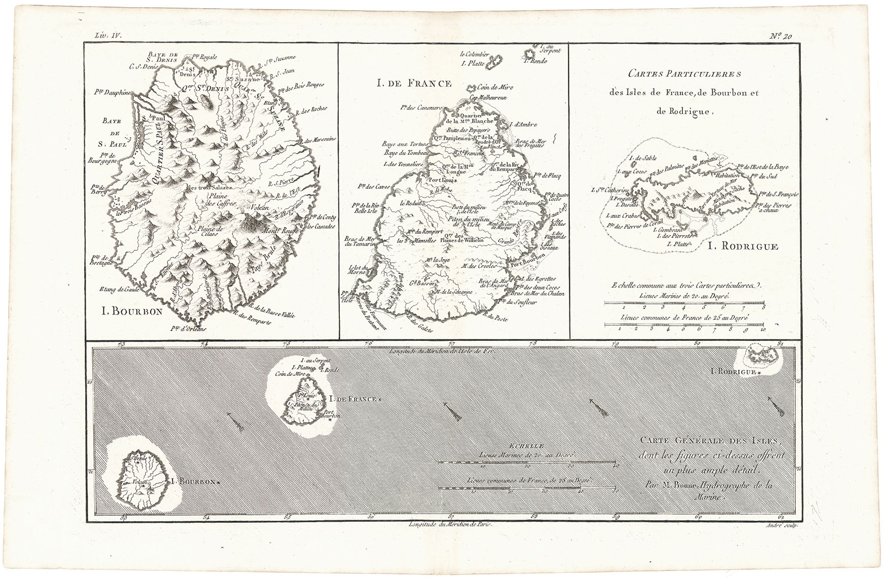
ARTIST: Rigobert Bonne
PUBLISHER: Published by J. L. Pelleret, Geneva.
MEDIUM: Copper engraving,
DATE: 1780
EDITION SIZE: Image size 9 1/8 x 13 9/16" (23.3 x 34.4 cm).
DESCRIPTION: From "Atlas des Toutes les Parties Connues du Globe Terrestre."Map of the Falkland Isalnds with two maps at rightm, one of the island ogf Georgia, the other titled "Terre de Sandwich."
ADDITIONAL INFO: This piece is in a 12 x 16 inch archival mylar for handling.
CONDITION: Fine condition. Black and white.
REFERENCE:


 Login / Register
 Basket