ARTIST: David Burr
PUBLISHER: Published by David H. Burr, NY.
MEDIUM: Copper plate engraving,
DATE: 1829.
EDITION SIZE: Image size 24 1/2 x 13 1/2" plus margins.
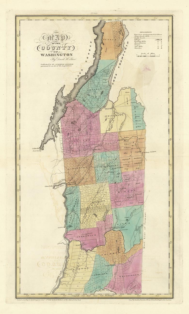
DESCRIPTION: A fine map from Burr's "An Atlas of the State of New York Containing a Map of the State and of the Several Counties. Projected and Drawn by a Uniform Scale... under the Supervision & direction of Simon De Witt, Surveyor General.…" "It is a magnificent publication and was the second atlas of an individual state ever published." (Ristow). Engraved by Rawdon Clark & Co. Albany & Rawdon, Wright & Co. N.Y. The map divides the county into numbered land allotment tracts, and names major landowners. Lake George and Lake Champlain are on the northern edge of the map.
ADDITIONAL INFO:
CONDITION: Good condition. Full original hand coloring.
REFERENCE:


 Login / Register
 Basket