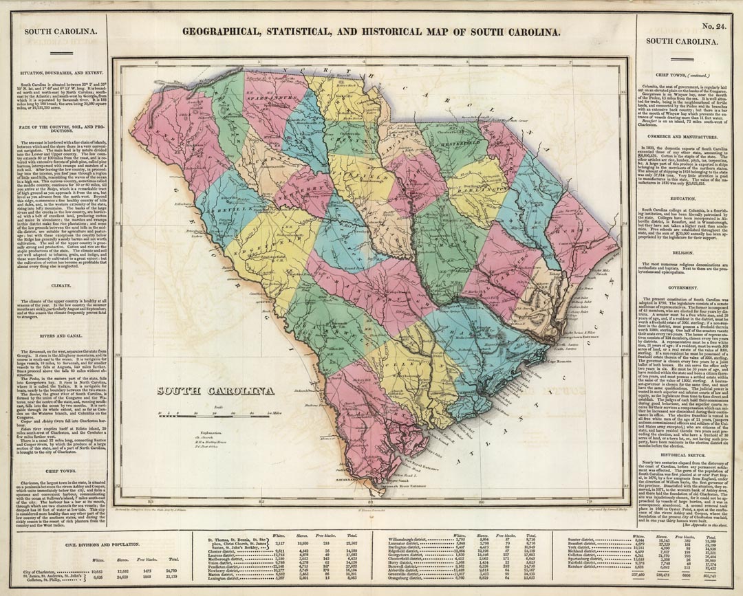
ARTIST: J. Drayton
PUBLISHER: Published by Carey & Lea, Philadelphia.
MEDIUM: Copper plate engraving,
DATE: 1822
EDITION SIZE: Image size 16 1/4 x 20 5/8" (41.3 x 52.6 cm) including text.
DESCRIPTION: A fine map from Carey and Lea's "A Complete Historical, Chronological, and Geographical American Atlas, . . ." This is one of the earlier maps of the state produced in America .The text provides a historical sketch and describes climate, topography, and political divisions. Engraved by Samuel Hufty.
ADDITIONAL INFO: 1827 edition.
CONDITION: Good codnition with original color.
REFERENCE:


 Login / Register
 Basket