ARTIST: Alexis-Hubert Jaillot
MEDIUM: Engraving,
DATE: 1694.
EDITION SIZE: Image size 23 7/8 x 18 1/8" (60.7 x 46.04 cm).
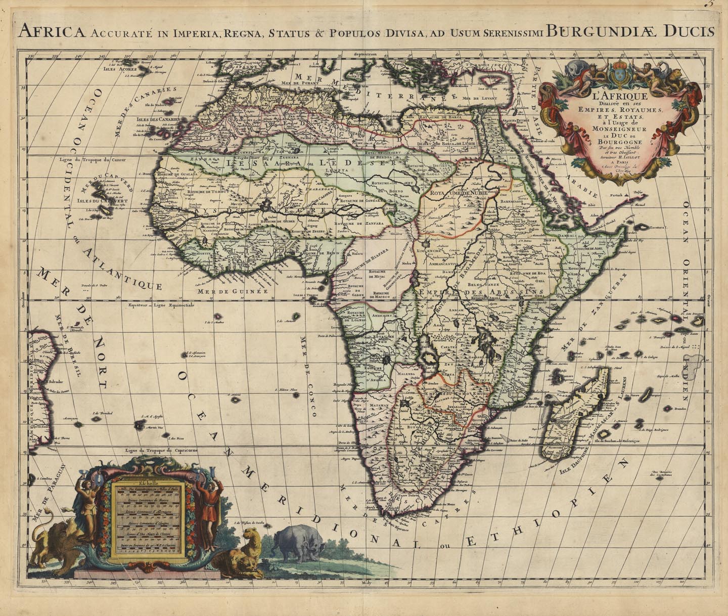
DESCRIPTION: Title above neat line: Africa Accurate In Imperia, Regna, Status & Populos Divisa, Ad Usum Serenissimi Burgundiae Ducis. A fine map of the whole continent of Africa. The continent is divided into regions, whose borders are drawn in detail and sometimes denoted with color. Shown on the map are numerous large lakes and rivers, deserts, mountains, and hundreds of place names. Most of this information is imaginary, as the interior was not explored until well into the 19th century. The origin of the Nile is based upon early geography by Ptolemy. The kingdom of Monomotapa comes down as far as the Rio de Infante. A decorative title cartouche shows human inhabitants, lions, and an elephant.
ADDITIONAL INFO:
CONDITION: Good condition, modern hand coloring.
REFERENCE:


 Login / Register
 Basket