Price: $2,000.00
SKU: 58065
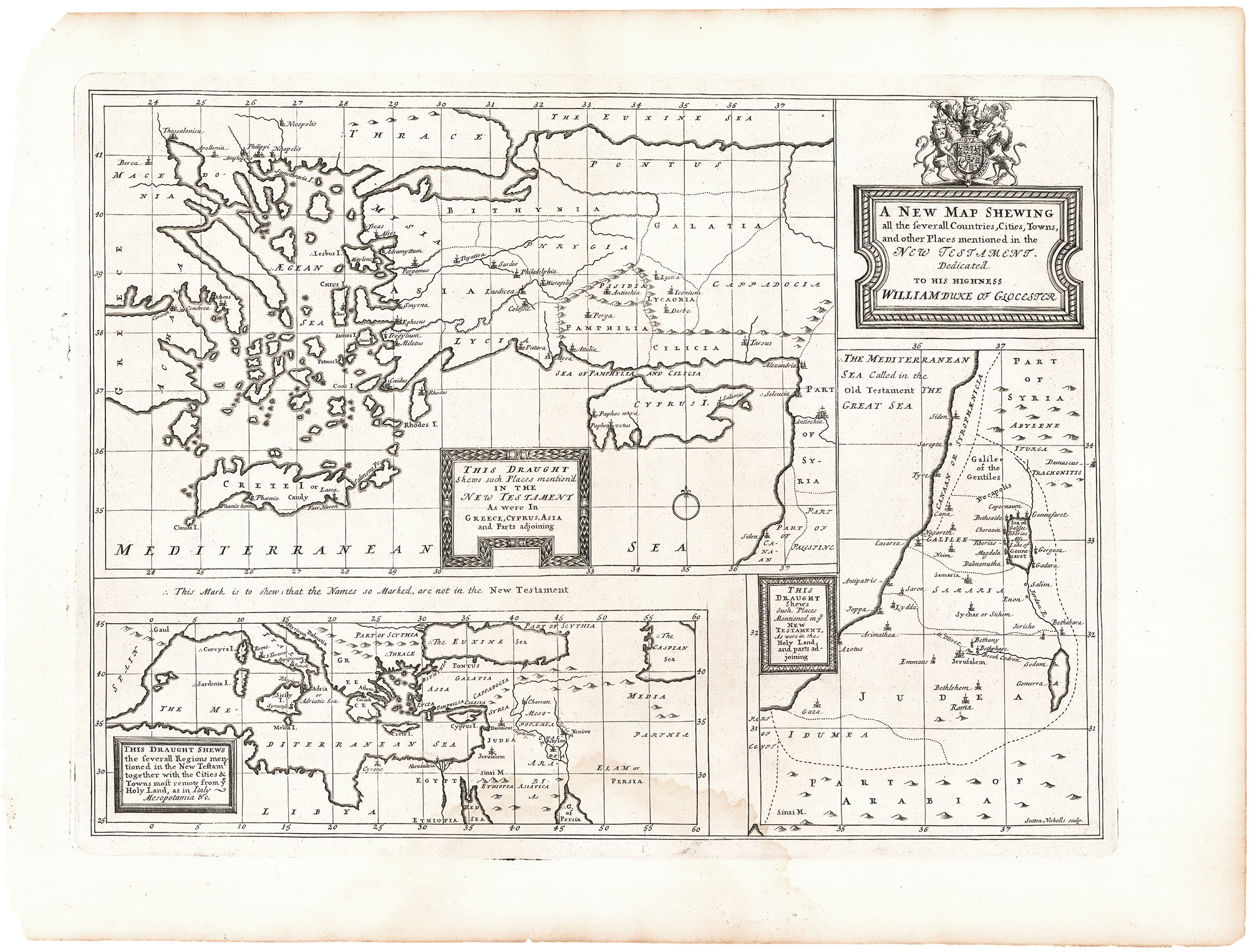
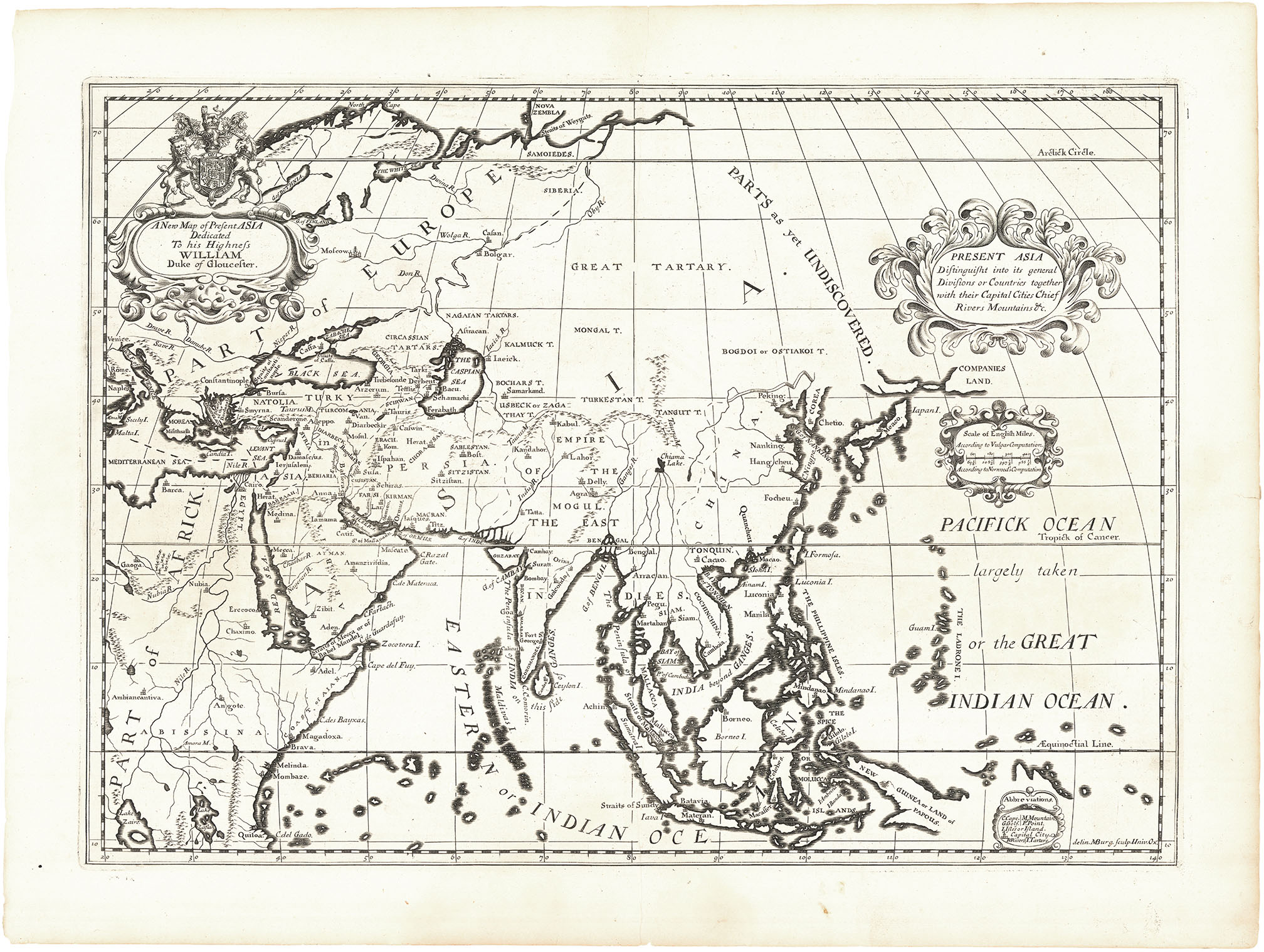
ARTIST: Edward Wells
PUBLISHER: Published by Edward Wells, Oxford and London.
MEDIUM: Copper engraving,
DATE: 1700-1738.
EDITION SIZE: Image size 14 5/8 x 20 1/8" (371 x 511 mm).
DESCRIPTION: Double-hemispheric world map showing California as an island. In North America, a legend explains that some believe it to be ancient Atlantis. This map does not show the Great Lakes or the Mississippi River. The direction of the shading along continental coasts distinguishes between ancient and modern knowledge of the continents. Southern Africa, Australia, Japan and the East Indies were unknown. Designed for instructional purposes, and dedicated to William, Duke of Gloucester, Well’s world map is graphic and appealing in its decoration and simplicity. Engraved by Michael Burghers.
ADDITIONAL INFO:
CONDITION: Good condition save restored side margins
REFERENCE: Shirley, World, 608, pl. 119.


 Login / Register
 Basket