Price: $1,975.00
SKU: 67568
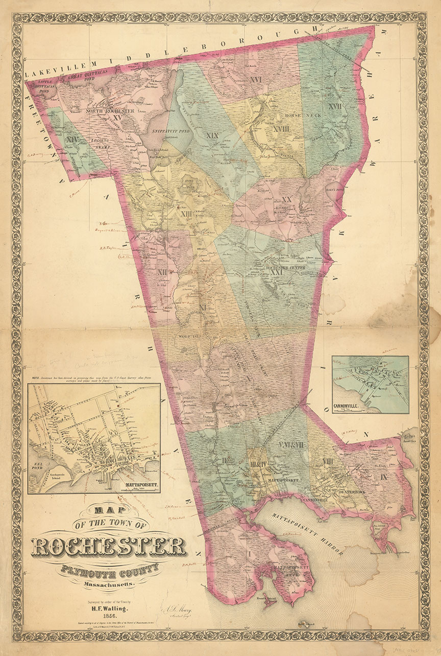
ARTIST: Henry Walling
PUBLISHER: Published by, Smith and Morley 106 Washington Street, Boston.
MEDIUM: Engraving,
DATE: 1856
EDITION SIZE:
DESCRIPTION: Engraved by Geo. Worley & William Bracher. Images in upper corners are "Andover Theological Seminary; City Hall, Newburyport." Images in lower corners are "City Hall, Lawrence; Court House, Salem." Many insets of individual towns giving fun details of roads, building structers, home owners names, etc. Many of the larger towns have business directories listed. Table of distances and inset of 'Geographical Map of Essex County' by Edward Hitchock.
ADDITIONAL INFO: Restored. Backed on new linen and finished with green cloth trim.
CONDITION: Good condition for a period varnished wall map.
REFERENCE:


 Login / Register
 Basket