Price: $1,350.00
SKU: 6722
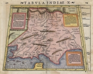
ARTIST: Sebastain Munster
PUBLISHER: Published by Sebastian Petri, Basel.
MEDIUM: Woodblock,
DATE: 1588
EDITION SIZE: 12 1/8 x 14" (31 x 35.4 cm) plus title and margins.
DESCRIPTION: A visually stunning “modern” world map that appeared in later issues of Munster’s Cosmographica. Cartographically, it is based on the work of Abraham Ortelius. The title is in gothic German and the corners are decorated by a florid vine leaf pattern. The map includes a marvelous depiction of the Northwest and Northeast passages. The massive unknown southern continent (Terra Australis Nondum Cognita) is retained, as are early references drawn from Marco Polo's travels, including the location of Beach near modern day Australia. Japan is shown, as are the Kingdoms of Quivira and Anian on the West Coast of North America. Florida, Nova Francia Granada, and Nova Hispania are other the regional names depicted in North America.
ADDITIONAL INFO:
CONDITION: Fair condition, lower margin expertly replaced and some minor marginal tears and small repairs along centerfold. Uncolored.
REFERENCE: Shirley, R. "Mapping of the World" #163.


 Login / Register
 Basket